|
Clark Co., Wis. Land & Property
Maps & Gazetteers
Introduction--"The Acquisition of Public Land"
Surveying Clark County (1842-1901)
Clark County, Wisconsin
Property Index
Additional Information
https://digicoll.library.wisc.edu/SurveyNotes/SurveyNotesHome.html
FIRST PATENTEES OF CLARK COUNTY, WISCONSIN
by Chuck Debevec
Land Owners [A] [AN] [B] [BAR] [BL] [BR] [BRO] [BU] [BUS] [C] [CH] [CL] [CO]
[COM] [CORW] [COU] [CU] [D] [DI] [DR] [E] [EB] [F] [G] [GO] [GR] [H]
[HAN] [HAS] [HE] [HO] [HU] [I] [K] [KI] [KL] [LO] [M] [MC] [ME] [MO]
[N] [O] [PE] [Q] [RO] [RU] [SC] [SH] [SI] [SP] [SPE] [ST] [T] [TI] [V] [W]
[WE] [WESTON]
[WESTON, SAM - 1] [WESTON,
SAM - 2] [WH] [WI] [WOODMAN-1] [WOODMAN-2]
[WOODS]
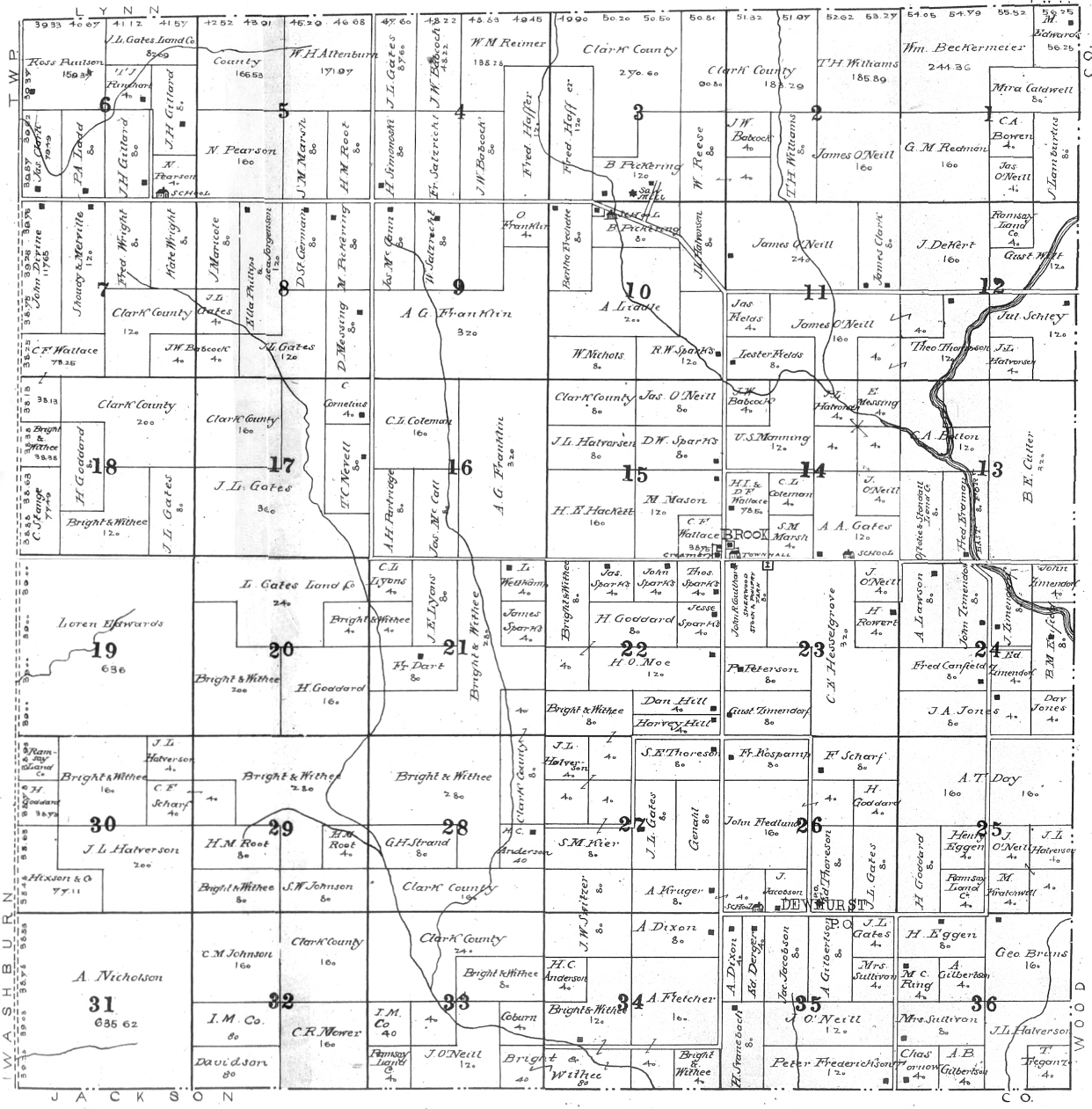
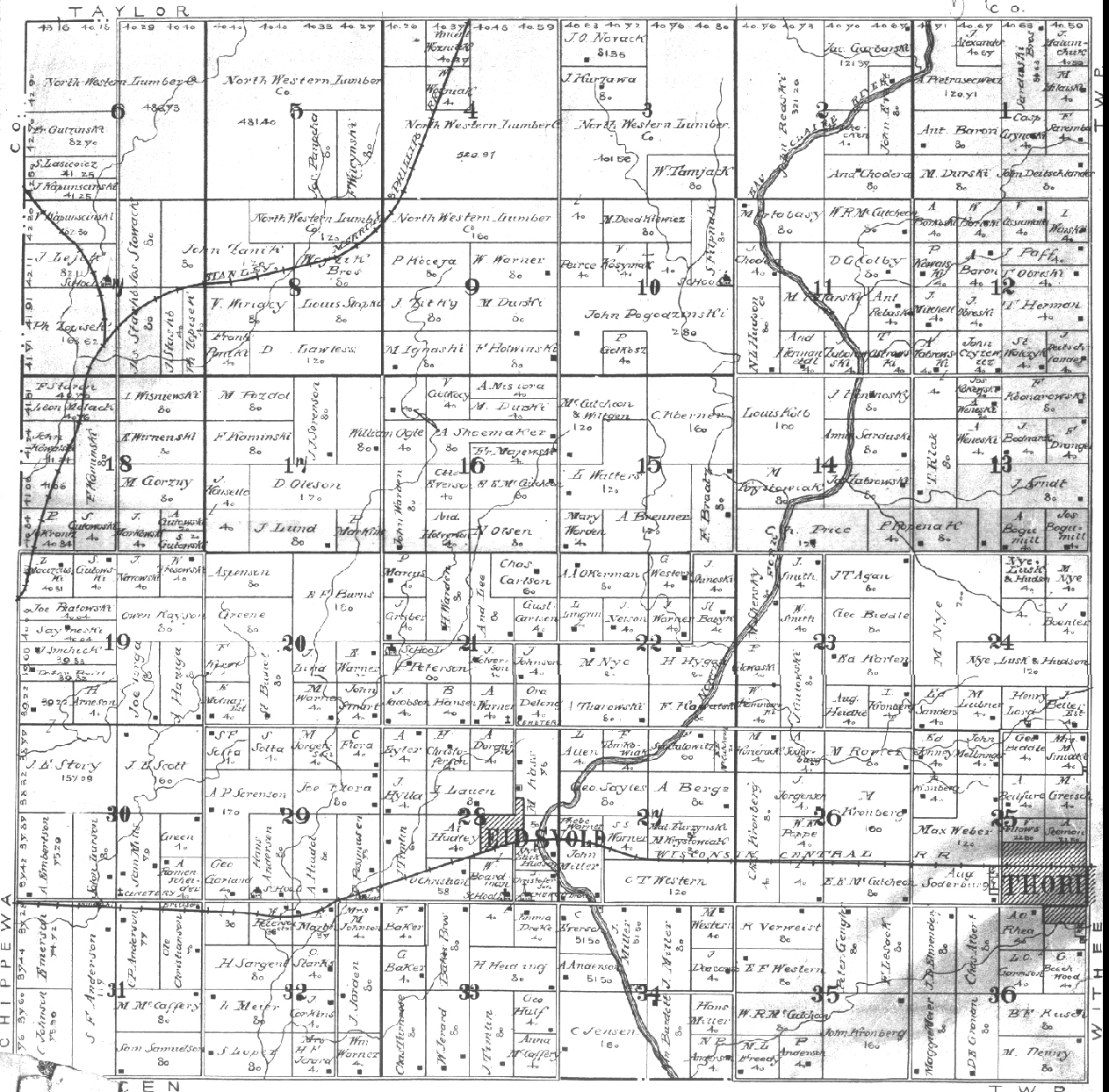
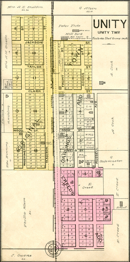
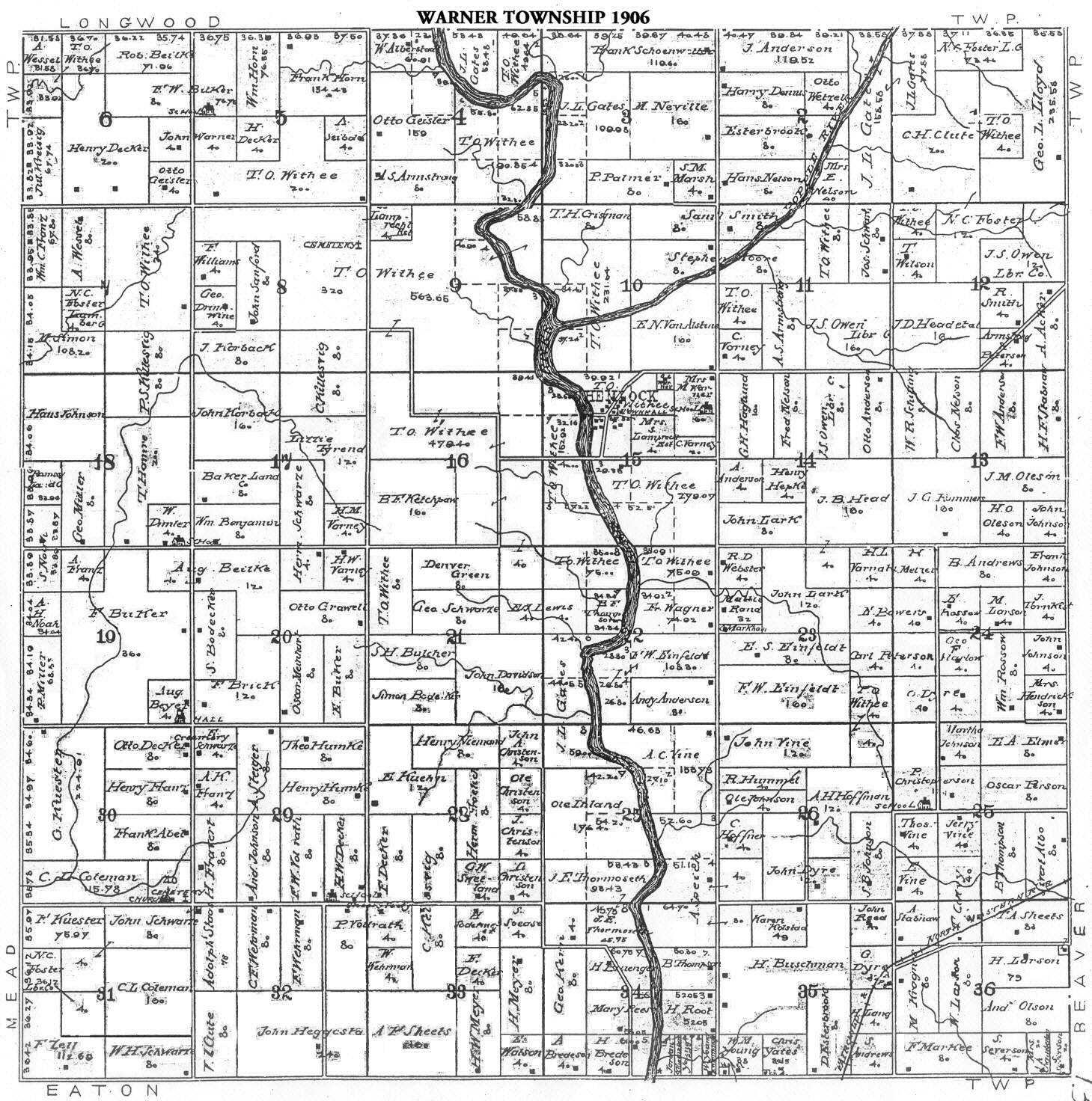
Townships
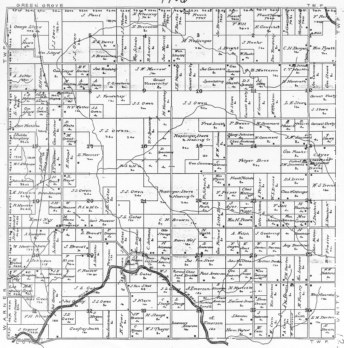
Beaver
Butler Colby
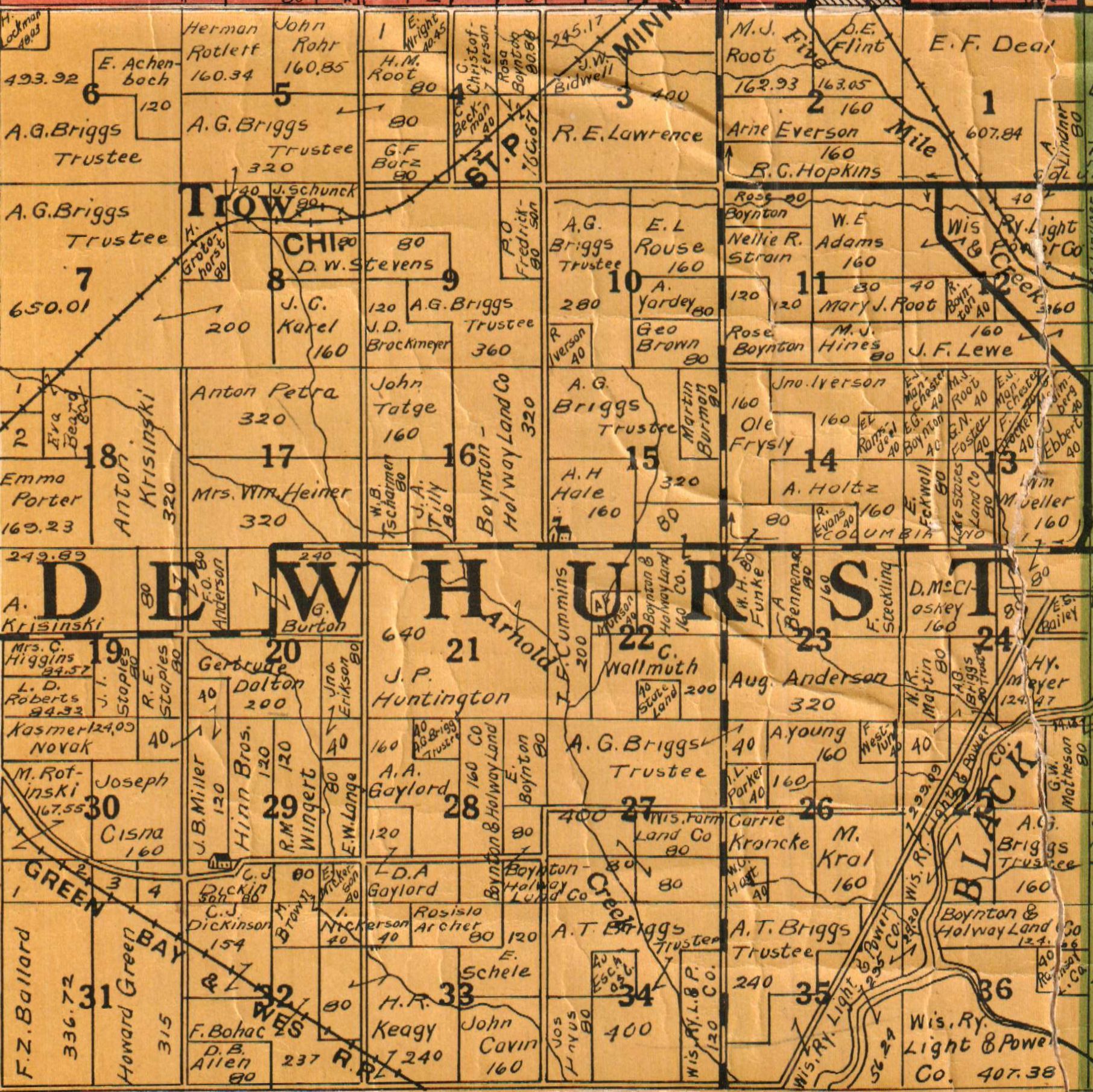
Dewhurst
Eaton Foster (North),
Foster (South)
Fremont
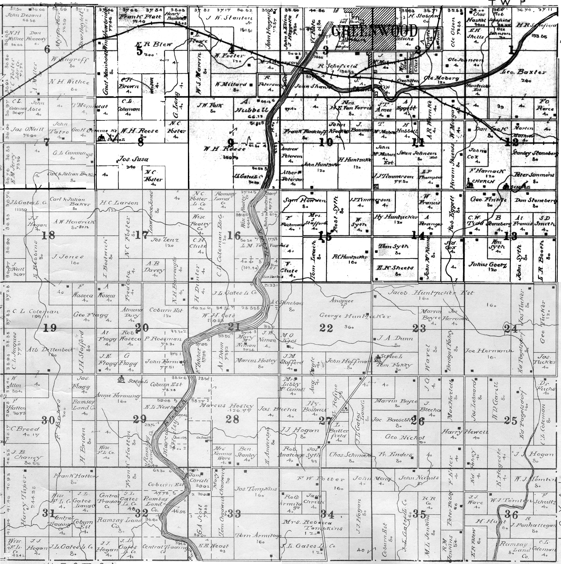
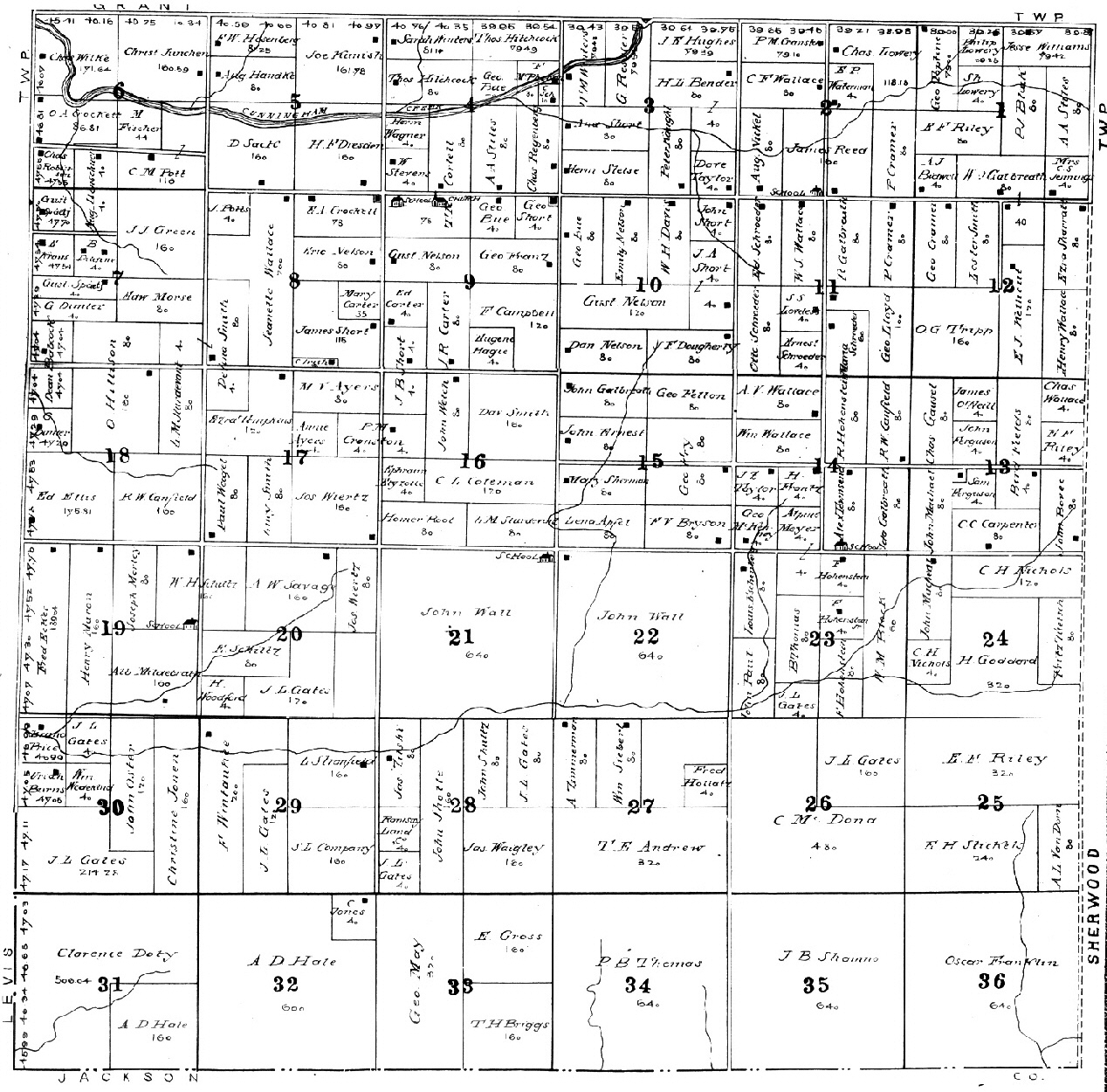
Grant Green Grove
Hendren
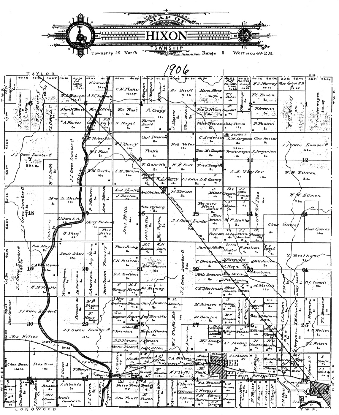
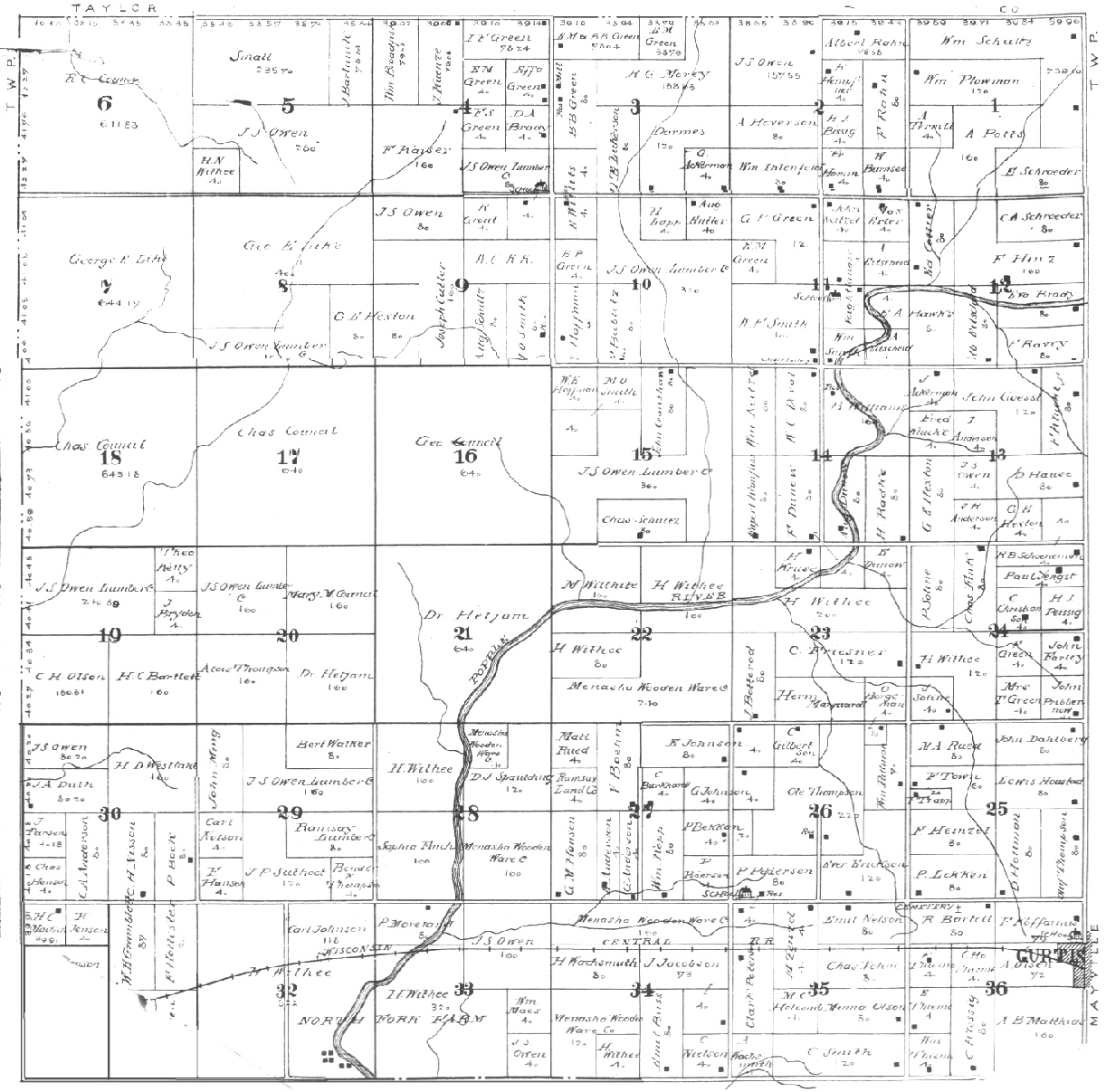
Hewett Hixon
Hoard Levis
Longwood Loyal
Lynn
Mayville
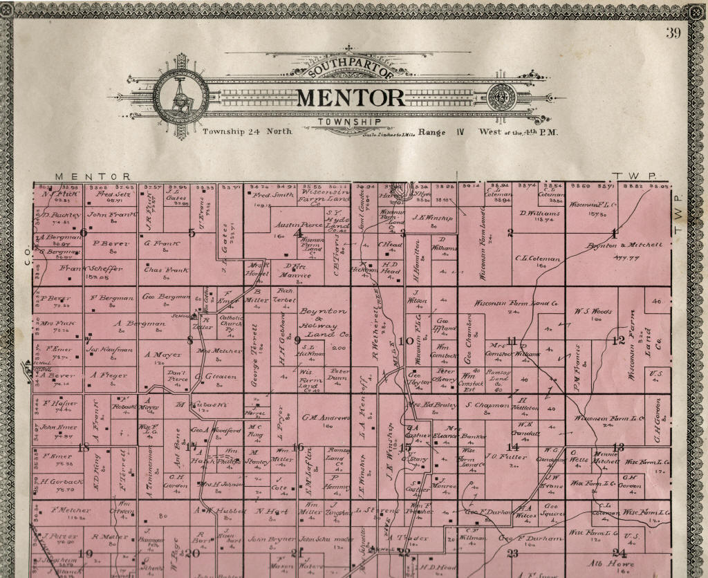
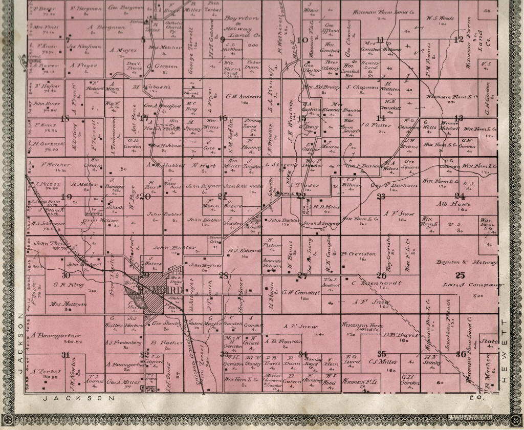
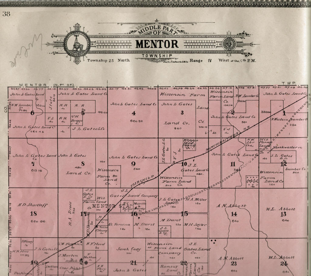
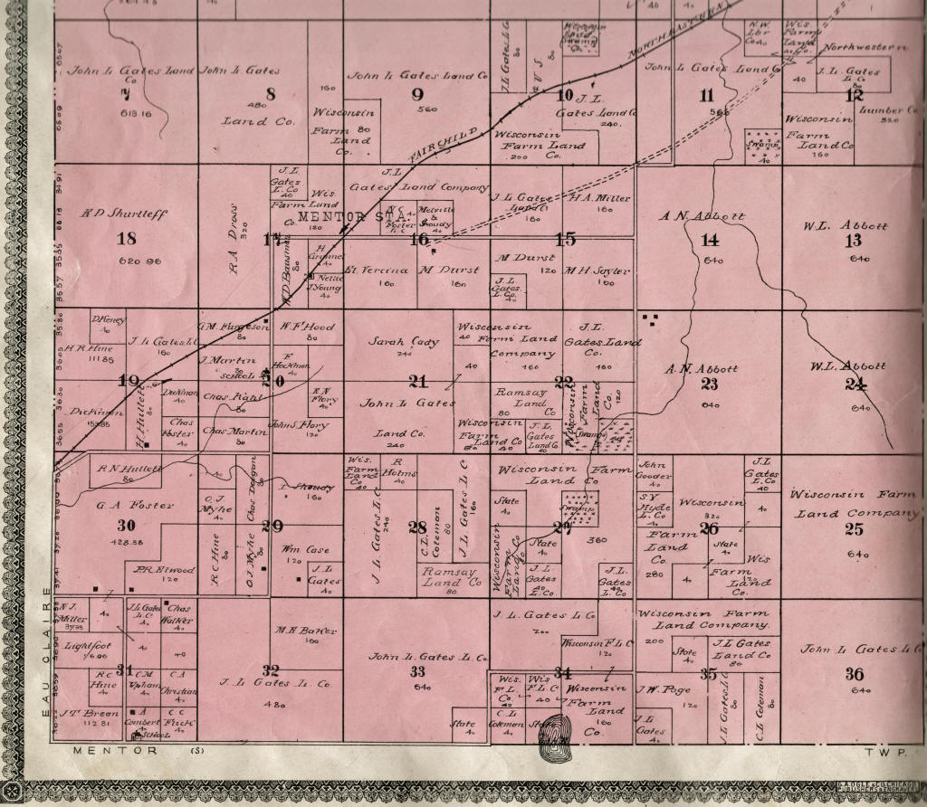
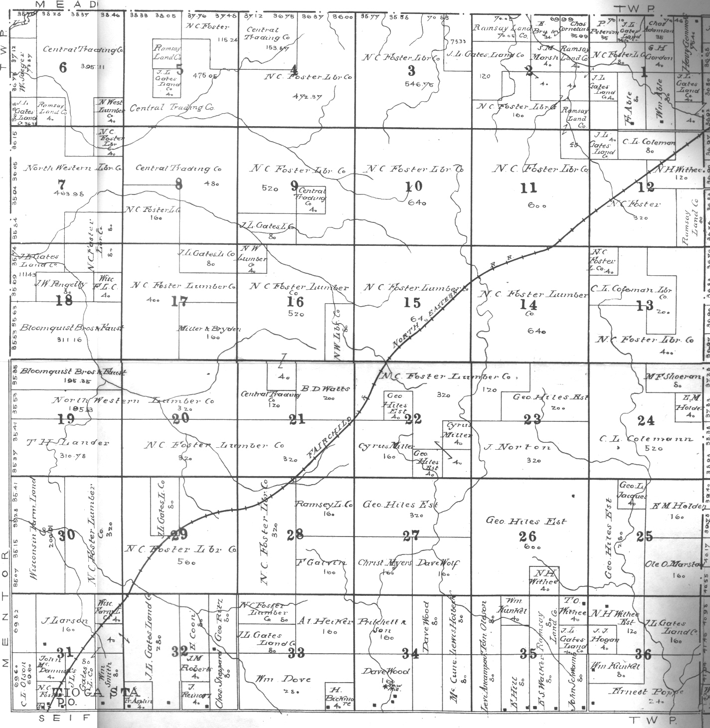
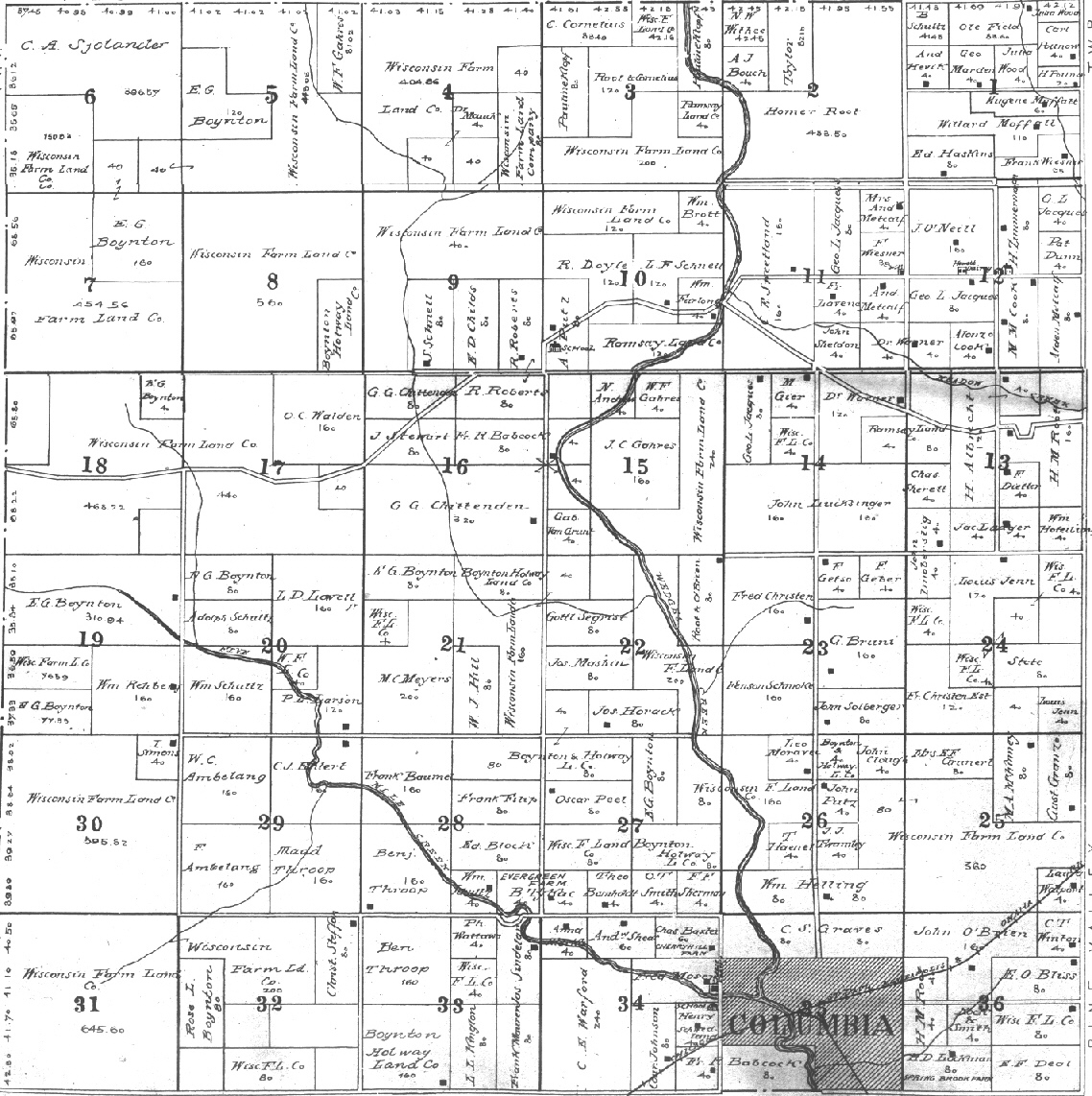
Mead Mentor
Pine Valley Reseburg
Seif
Sherman Sherwood
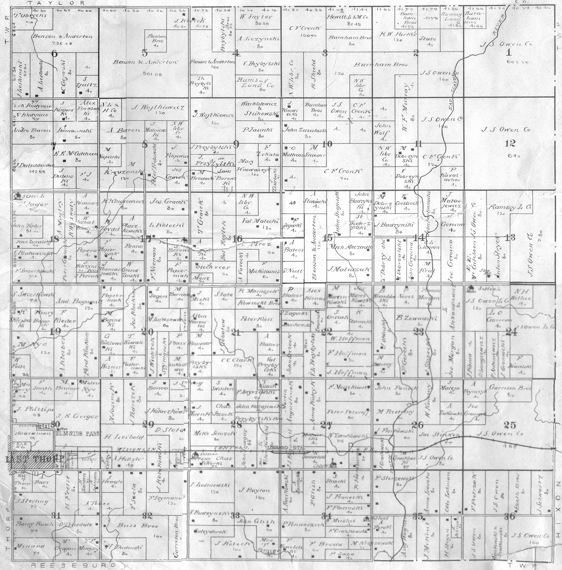
Thorp
Unity
Warner Washburn
Weston Withee
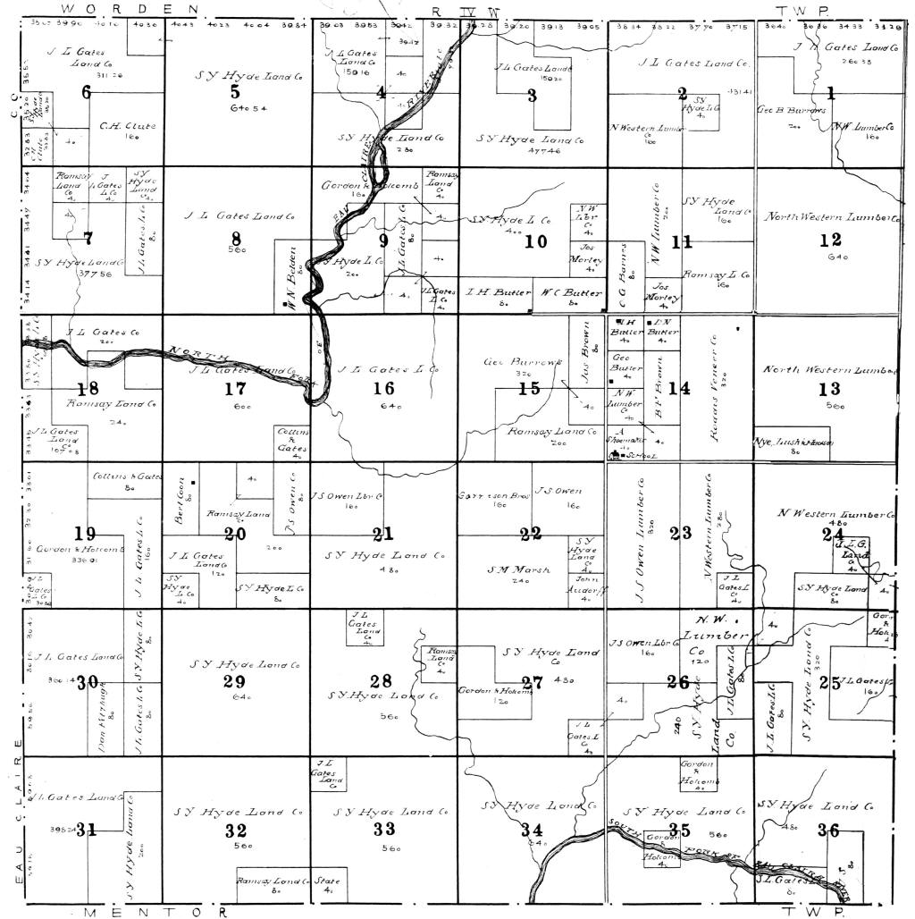
Worden
York
Original Warrantees [A]
[D] [G] [L]
[O] [S] [W]
Wisconsin State Maps
1882 Wis. Atlas & Plat Map.
1915 North-Central Wisconsin Soil Map.
County Maps
1854 Clark Co., WI Township Map.
1857
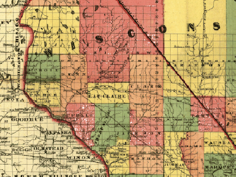
Central WI (when Clark County was much bigger!);
Enlarged Copy; contributed by
Pat Phillips.
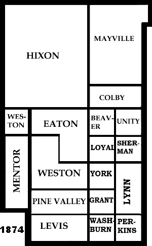
The Clark County Map Changes (1856 - 1874).
1871
Minnesota/Wisconsin RR;
Enlarged Copy;
Pat Phillips.
 1895
Rail Road Map; Enlarged Copy;
contributed by
Pat Phillips. 1895
Rail Road Map; Enlarged Copy;
contributed by
Pat Phillips.
1901
Atlas
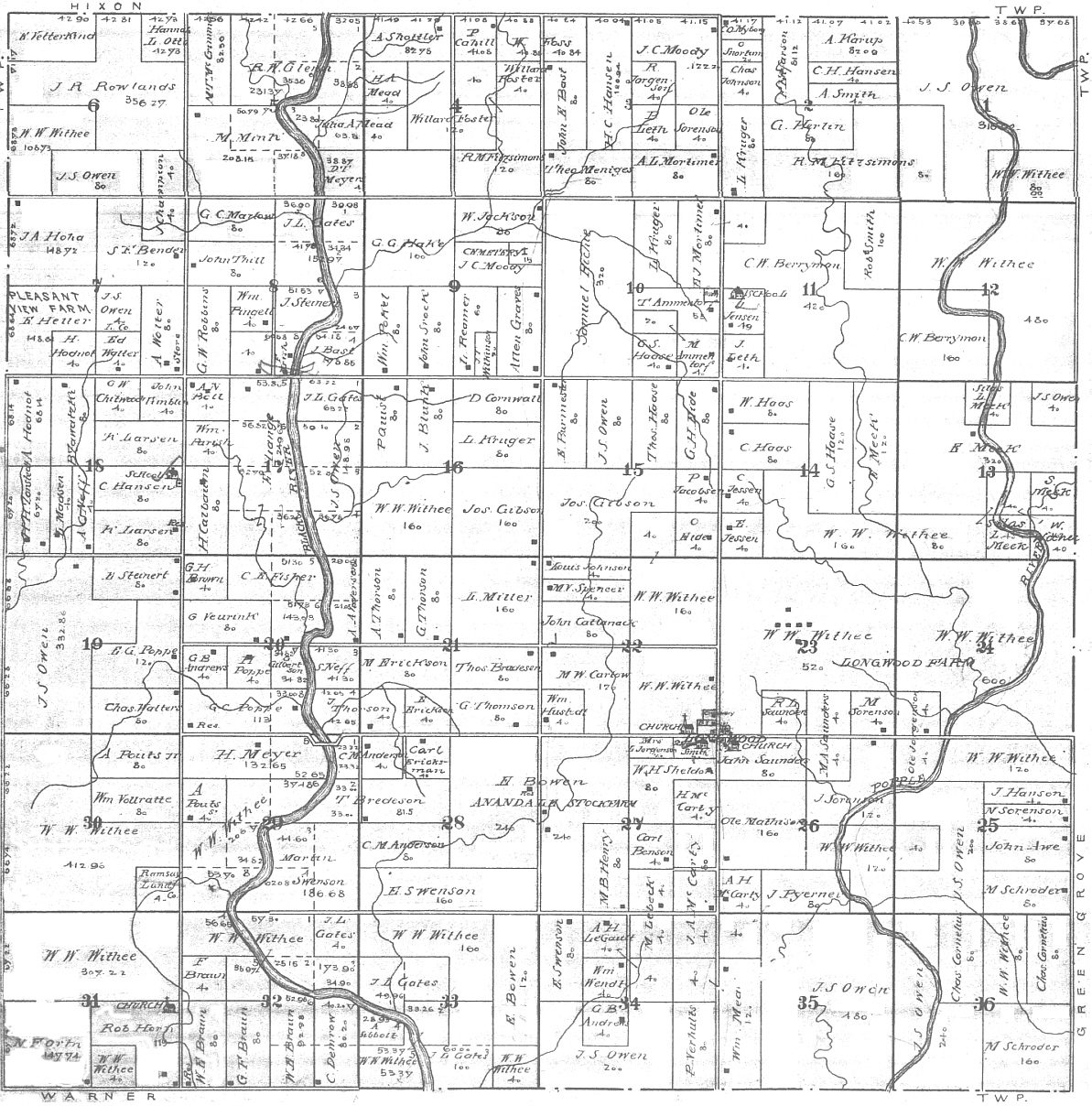
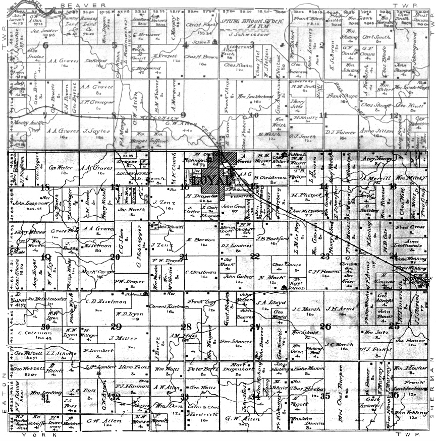
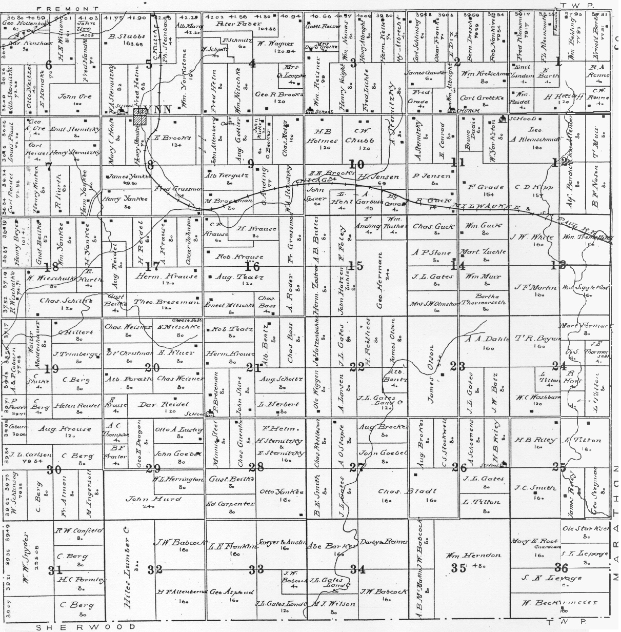
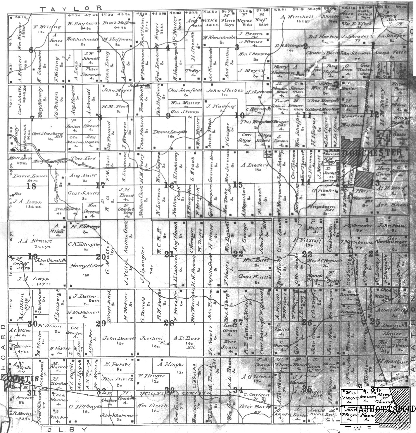
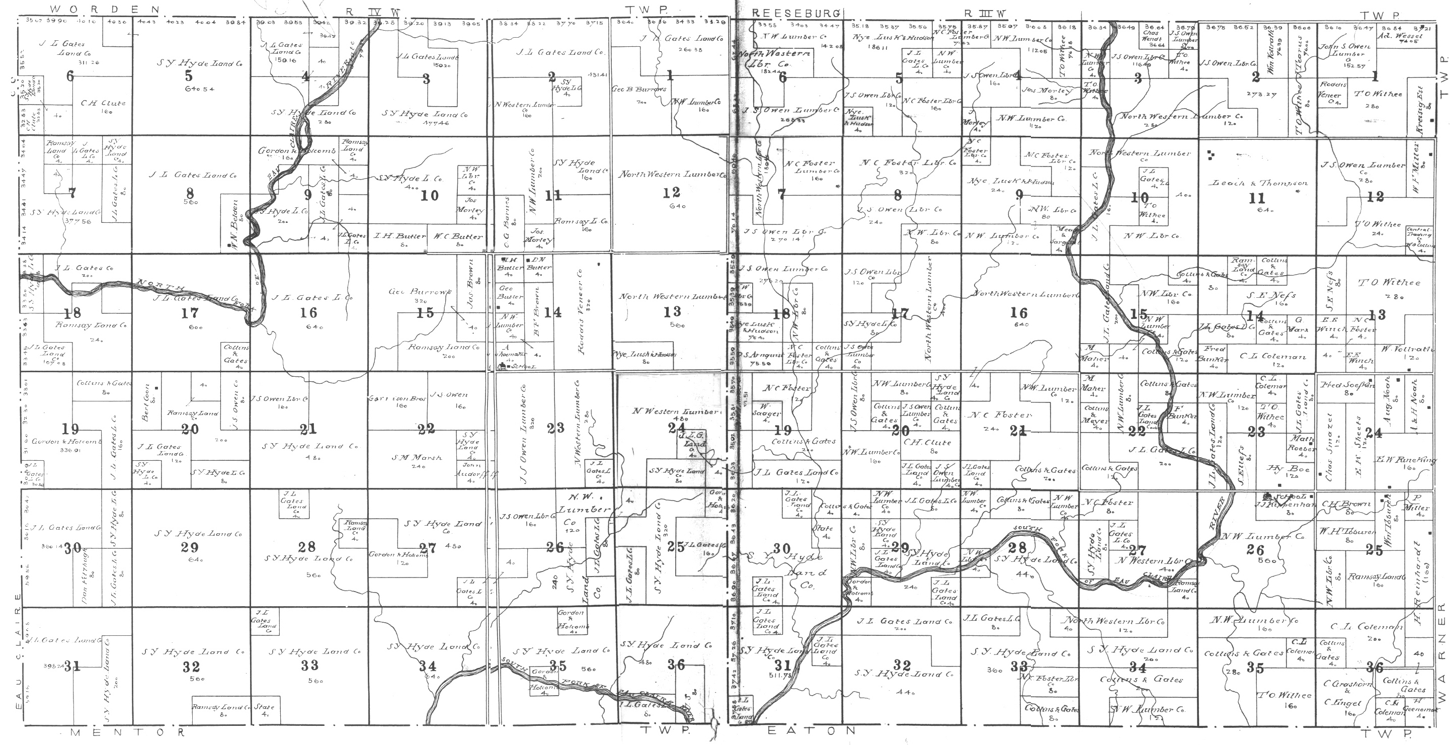
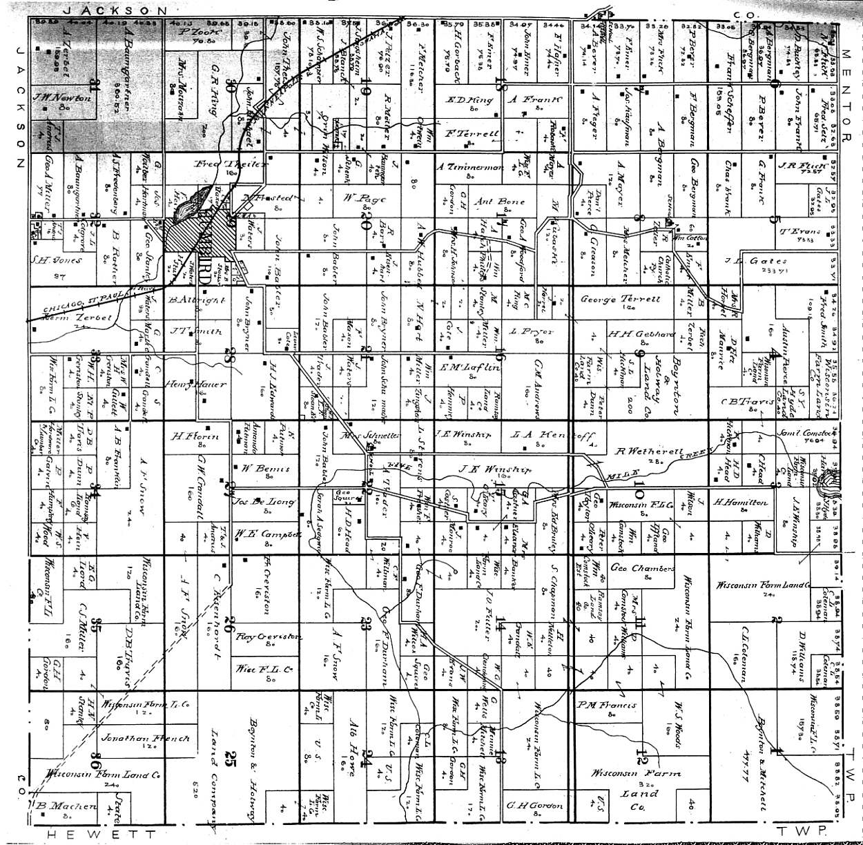
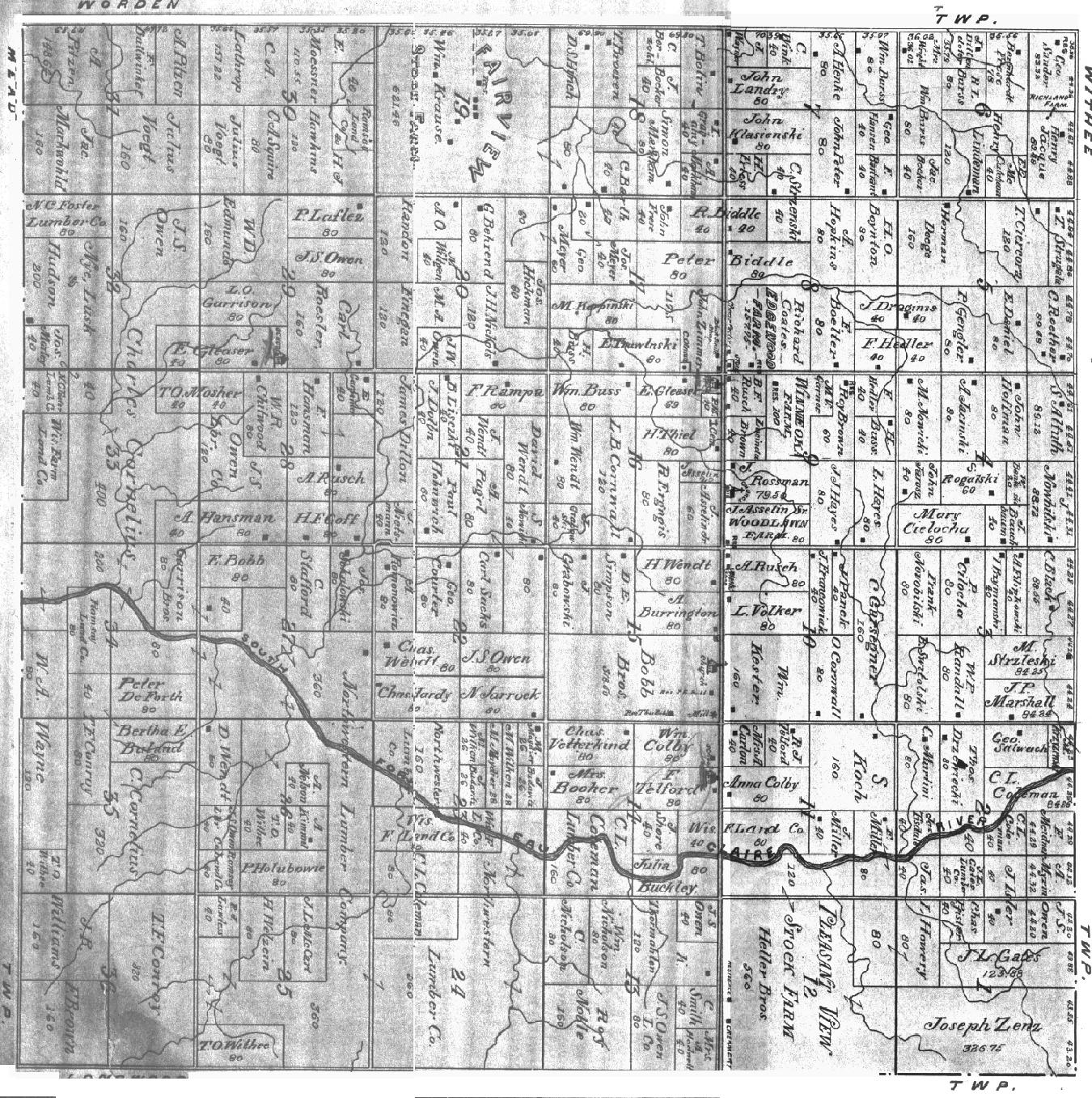
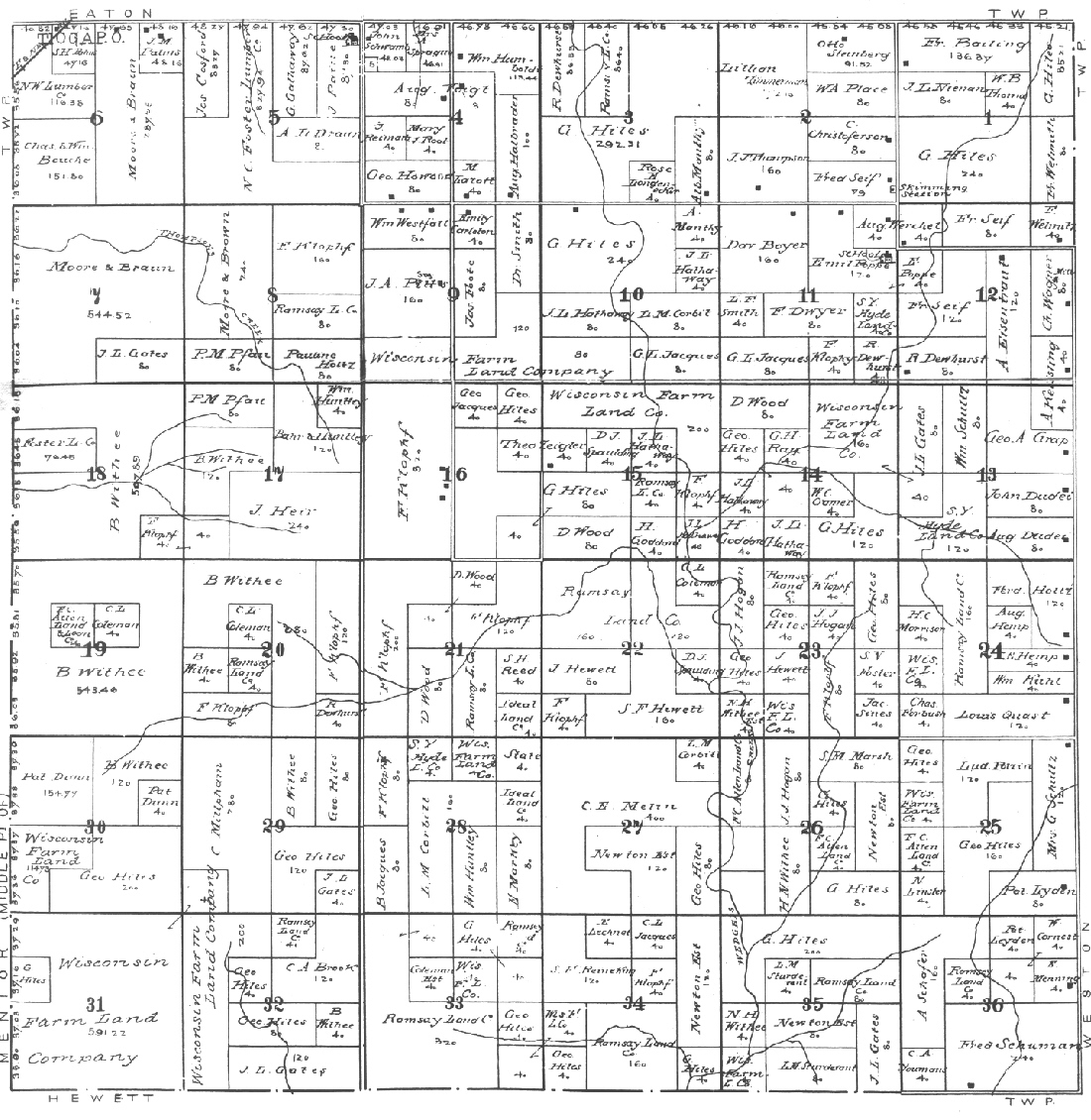
County Map (shows all the townships)
1906 Atlas & Plat Book--Cover,
Beaver,
Butler,
Colby,
Dewhurst,
Eaton,
Foster North
[part 1]
[part 2], Foster
South [part 1]
[part 2]
*at this time Foster was the northern 2 townships of Mentor, Fremont,
Grant, Green
Grove, Hendren,
Hewett,
Hixon,
Hoard, Levis,
Longwood,
Loyal,
Lynn,
Mayville,
Mead,
Mentor, Pine Valley,
Reseburg,
Seif, Sherman,
Sherwood,
Thorp,
Unity,
Warner,
Washburn, Weston,
Withee,
Worden, York.
1923
Clark Co. Map
Town Maps
2002 Neillsville
Related Links
Cartographer's Office
Public
Land Records
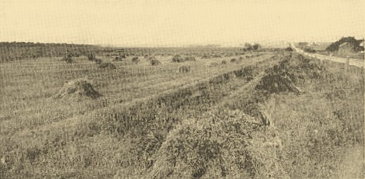
Clark County, Wisconsin Oat Field
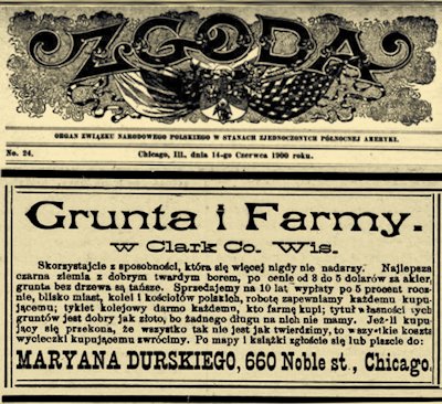 |
Zgoda = Unity.
June 14, 1900, Page 378
PIG FARMING?
Take advantage of abilities that are never more gifted. ? fiery land
with good hardwood, priced from 8 to 5 dollars. Fare for
railway ticketing free for everyone who buys a farm; the title and
property of those soils is as good as gold, for we have no greedy
debt for them. If you are convinced that everything is not as strong
as it is, then costs will be returned to the buyer. On the map, 1
book is written or written to:
MARYANA DURSKIEGO, 660 Noble St, Chicago.
*Translation may not be exact.
Contact us
if you have corrections. |
|